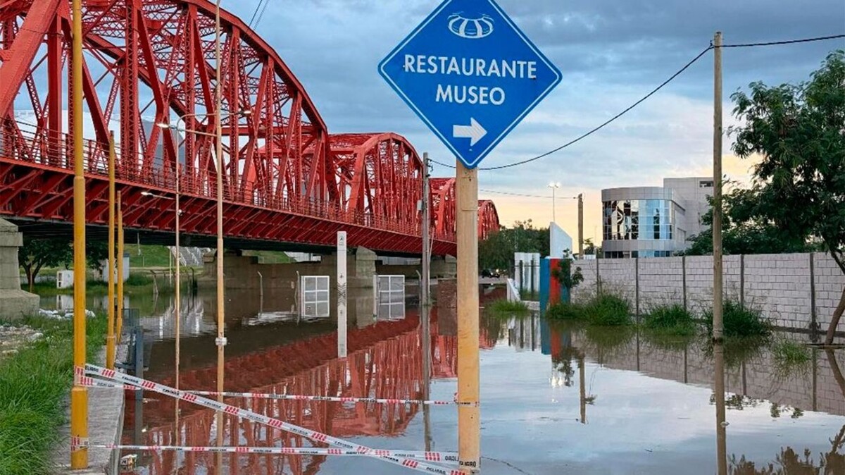
Santiago del Estero, March 15 (NA) – The historic water mass originating from intense flooding in the province of Tucumán is impacting Santiago del Estero territory, where the Dulce River is experiencing one of the most significant floods in recent decades. Although the situation in the Costanera and Parque Aguirre areas has stabilized this Sunday, the scenario in the capital and the city of La Banda remains on alert due to the critical flow of water coming from the north. After the significant rise in water levels, the situation in areas near the riverbank has remained practically unchanged compared to Saturday, although vast areas are still flooded due to seepage. Santiago del Estero is enduring one of the worst floods in decades with a flow exceeding 1700 m³/s. Authorities reported that the inflow from the rivers feeding the dam reaches 1,656 m³/s, while the outflow to the Dulce River is maintained at 1,798 m³/s to relieve pressure on the structure. Although the water level remains stable, the views continue to surprise residents and visitors with leaks in critical points connecting Santiago with La Banda. The flood coming from Tucumán has key sectors of the capital and La Banda under water. Despite a slight increase in water levels in some specific areas, no significant advance has been recorded in the last few hours, providing a technical respite from the natural disaster that previously struck the province of Tucumán. The hydrological phenomenon, which began with the overflowing of Tucumán's tributaries, has required constant monitoring of the Río Hondo reservoir to regulate the passage of water to the main course. Currently, according to the latest hydrological data, 'the situation of the Río Hondo reservoir shows signs of stabilization,' with a level at 274.30 meters above sea level.